 UseCasesFor.ai
Choose Topic
 UseCasesFor.ai
AI Use Cases
A collection of over 250 uses for artificial intelligence
A continually updated list exploring how different types of AI are used across various industries and AI disciplines,including generative AI use cases, banking AI use cases, AI use cases in healthcare, AI use cases in government, AI use cases in insurance, and more

Sign up
to receive a PDF containing all the use cases and stay updated with the latest AI trends and news (you can always unsubscribe)
Satellite imagery analysis

Introduction
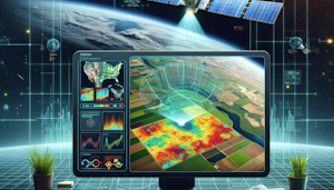
The use of satellite has bring about a great change in the way we are able to view the earth and therefore the way we are able to understand it. Even in the current world, these advancements have been embraced in the agriculture sector through the use of Computer Vision AI in analyzing the satellite images. This new approach involves the application of machine learning models that analyze images and provide insights that can be used to make better decisions in the agricultural domain. It has the possibility of enhancing crop yields, assessing the output, optimizing on resources, and helping in reducing effects of climate change. But as with any technology, there are some issues that needs to be addressed when implementing this technology.
Challenges
There are several challenges that arise when trying to implement Computer Vision AI into satellite imagery for agriculture. First, one needs a lot of data to develop the system and such data is costly and may take a lot of time to accumulate. In addition, the data should be of high quality that is without noise and other interferences. Second, understanding the data can be challenging because of the various types of crops, the different growth stages of crops, and factors such as weather that may affect the quality of the images. Third, there are concerns on the privacy and security of the satellite data particularly when it comes to private properties. Fourth, the technology also needs a lot of computational power and skilled personnel to design and install. Last but not the least, farmers may not easily accept this new technology because they may perceive it as being complicated and expensive.
AI Solutions
There are, however, a number of issues that can hinder the use of satellite imagery and AI in agriculture, including the quality of the data. To solve such challenges, there is a need to come up with machine learning models that will be able to identify crops and even give a prediction of the yield that is expected from the farm using satellite images. Some examples of companies that are applying AI in analysis of satellite data include Descartes Labs which analyses large quantities of satellite data to help farmers with decision making. Similarly, Orbital Insight uses AI techniques to analyse satellite images and identify trends in agricultural output. Also, services such as Google Earth Engine offer tools for processing of satellite data with the help of AI for scientists and developers. Thus, these solutions can address the problems of data availability, analysis, and protection, and at the same time, enable farmers to use the technology.
Benefits
There are numerous advantages of using CV AI in satellite imagery for agriculture. First, it may assist the farmers in enhancing the production and quality of the crops by offering information about the health of the crops, the quality of the soil and the weather conditions. Second, it also enhances the efficiency of resource management as the farmers can be able to pinpoint certain areas that require irrigation, fertilization or pest control. Third, the technology can also assist in determining and preventing the effects of climate change on agriculture through tracking alterations in weather and land use. Lastly, through the provision of correct real time information it can assist the farmers to make better decisions hence enhancing their profitability and sustainability.
Return on Investment
It can be expensive to implement CV AI in satellite imagery analysis but the returns can be even higher. A study by McKinsey found that the use of sophisticated AI technologies has the potential of adding $500 billion to the global agriculture value addition. Also, the technology has the potential of reducing costs in the long run by minimizing on wastage and increasing efficiency. For example, The Climate Corporation which is a Monsanto company stated that its AI platform which uses satellite imagery to help farmers made its farmers to save $11 per acre. Based on these potentials, the investment on AI for agriculture using satellite imagery can be considered a good decision.